A trekking in the heart of the central massif, with departure and return from the Aosta train-station, between lakes and peaks of extraordinary beauty, modulable according to your time, your desires and skills
TOUR TERSIVA EMILIUS
4 Days
40 Km
2343 Mt D+
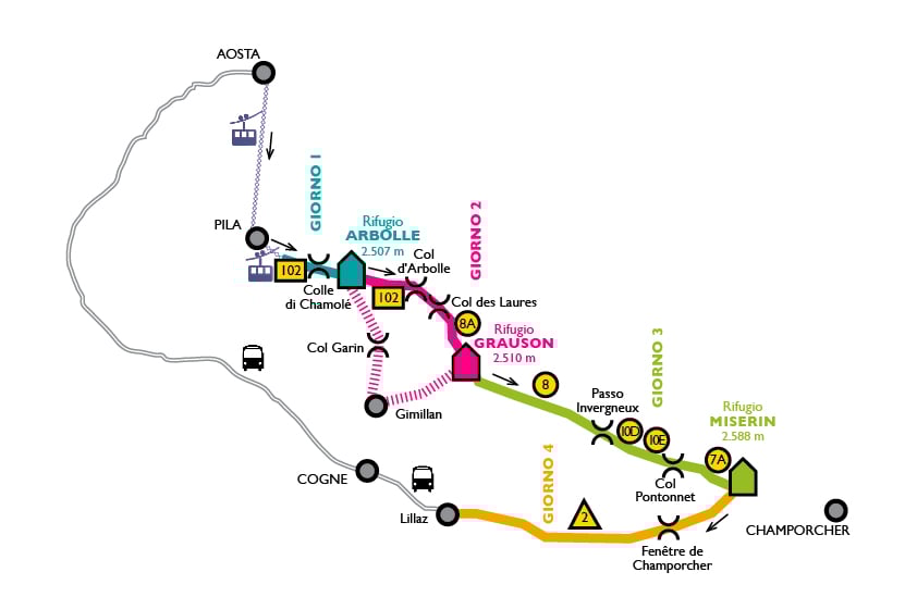
The tour
TTTE stops
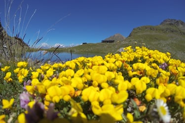


Refuge Arbolle
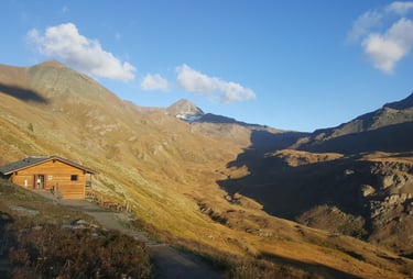
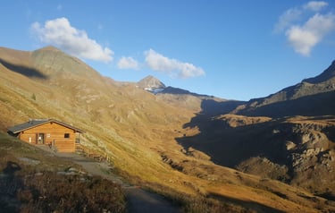
Refuge Grauson
Refuge Miserin
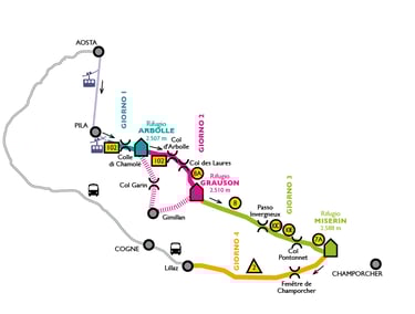
DAY 1: Aosta › Pila › Chamolé › Rifugio Arbolle
From AOSTA BUS AND TRAIN STATION, take Aosta - Pila CABIN and then Chamolé CHAIRLIFT; from Chamolè lake go on 102 path till the refuge Arbolle
Walking time: 1h30 - Distance: 2,7km - Elevation at the start: 2.309 m - Elevation at arrival: 2.507 m - Highest point: 2.649 m (Col Chamolé) - Elevation gain: 375 m - Difficulty: E - Path 102
DAY 2: Refuge Arbolle › Refuge GRAUSON
From Refuge Arbolle take 102 path to Col d'Arbolle walking in a lonely and wild alpine environment (going down from Col d'Arbolle to Col Laures can be steep and slippery in some season, ask the refuges' owners to know current condition of the path)*, go up to Col de Laures (path 4)and then walk down to the beautiful Lakes of Lussert (path 8A) getting, through wide and green meadows, to the refuge Grauson.
*Otherwise you can get to Refuge Grauson by Col Garin, Gimillan, Grauson (E difficulty) through the wonderful Vallone di Arpisson and Vallone del Grauson (path TVC)
Time: 5h - Distance: 9 km - Elevation at the start: 2.507 m - Elevation at arrival: 2.510 m - Highest point: 3.155 m (Col d’Arbolle) - Elevation gain: 753 m - Difficulty: EE - Paths: 102 - 8A
DAY 3: Refuge Grauson › Refuge MISERIN
From Refuge Grauson go on on the small river side, looking to the huge pyramid of Mount Tersiva; you'll walk alongside Doreire e Pontonnet lakes, till entering the National Parc of Mont Avic (dogs on a leash). The Refuge Miserin stand in front of the homonymous lake.
Time: 4h40 - Distance: 14 km - Elevation at the start: 2.510 m - Elevation at arrival: 2.588 m - Highest point: 2.900 m (Col Pontonnet) - Elevation gain: 816 m - Difficulty: E - Paths: 8A - 8 - 10D - 10E - 7A
DAY 4: Refuge Miserin › Lillaz › Cogne › Aosta
from refuge Miserin take AV2 path going through Fenêtre de Champorcher, on easy slopes you can get to Lillaz, from here you can take the free shuttle to Cogne and then the BUS that goes back to AOSTA BUS/TRAIN STATION.
You can't join AV2 path with your dog in the section going down to Lillaz (part of Gran Paradiso National Park). you can get to Lillaz by path number 10.
Time: 4h20 - Distance: 14,5 km - Elevation at the start: 2.588 m - Elevation at arrival: 1.613 m - Highest point: 2.819 m (Fenêtre de Champorcher) Elevation gain: 401 m - Difficulty: E - Path: AV2
If you have more days, for a longer staying, visit the page VARIANTS and build your own TOUR!

!!! * DAY 4: You can't join AV2 path with your dog in the section going down to Lillaz (part of Gran Paradiso National Park). You can get to Lillaz with your dog by path number 10.